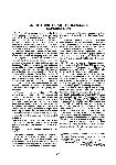
An Historic Chart of Batman's Exploration
The first serious attempt to explore the Port Phillip region to assess its suitability for settlement was made by John Batman between 29 May and 7 June 1835. Shortly after his return to his home near Ben Lomond in Tasmania, he was visited by John Helder Wedge, a surveyor, who, like Batman, was interested in forming an association for the settlement of Port Phillip. Wedge stayed at Kingston, Batman's home, during 14 and 15 June, drawing a map of the exploration and of the boundaries of the land Batman has allegedly purchased from the Aborigines of the district. As Batman had determined positions during his journey only from estimates of distances travelled and from compass directions, Wedge had a difficult task. Although he was able to indicate reasonably accurately the southern boundaries of the land claimed, he achieved only a rough approximation of the northern geographical lay-out. The original or a copy of the map with Batman's deeds of his alleged treaty with the Aborigines was forwarded on 25 June 1835 to Lieutenant Governor Arthur of Van Diemen's Land (Tasmania) for forwarding to the British Government. The House of Commons ordered the map to be printed on 1 August 1836, lithography by J. Arrowsmith.
In March 1982, the State Library of Victoria arranged an exhibition entitled “Trespassers and Intruders”, relating to the Port Phillip Association and the founding of Melbourne. As part of the exhibition, a map was displayed and catalogued under Russell, Robert. Victoria, c. 1835, 821 A. Its provenance was unknown. One of us (A.H.C.) realist that it closely resembled Wedge's map printed by the House of Commons. It is a partly coloured map mounted on canvas and creased from previous folding. It is numbered 6272 and notated as follows:—
“This is the plan referred to in my memo of the 12th June 1883 and in a letter to Mr R. Russell written by Mrs Eliza Newton the widow of Mr E.T. Newton.
2 August 1883 W.W. Walduck, witness Robert Russell”.
This century-old notation provided an important clue, as fortunately Robert Russell's correspondence has survived in the La Trobe Collection.
1 He had written in 1883 to Mrs. Newton about the map which had been recently purchased by a friend from Mr. Walduck. He surmised that it was the original plan, or a copy, of Batman's explorations. Mrs Newton replied on 30 June 1883 informing Russell that:
“The plan you speak of came into his (Newton's) possession before my marriage in 1840.1 have heard him say he bought it with some old Books at the sale of Batman's effects. Mr Newton was one of John Batman's executors, it is one of Mr Wedge's plans, I think it must be the original one as we had some little time back a piece of paper signed by half-a-dozen blacks, ceding the land to Batman…” She had asked Walduck to sell the map for her.
E.T. Newton was formerly Batman's superintending clerk and, after 23 June 1839, an attorney of the executors of Batman's estate. The sale of Batman's effects took place on 7 June 1835 while the widowed Eliza Batman was still overseas.
The map could be either Wedge's original or one of the early copies made in Hobart. With the formation of the Port Phillip Association for the purpose of exploiting the discovered land, copies were made of Wedge's map to send to the authorities and, for the purpose of excluding interlopers, “5 charts coloured of the Dutagalla and Geelonglands” were prepared by Joseph Pettingell for the “Gentleman of the Committee of the New Colony” for £12.12.6 and paid for on 13 July 1835.
2 Batman also arranged with Henry Wilkinson of Hobart Town to draw “5 plans of Port Phillip finished and mounted” for £2.12.6 each. The account was dated 7 July 1835 and the plans were delivered to Mr. Collicott, one of the members of the Port Phillip Association, and paid for on 13 July.
3 It can be concluded that the map previously catalogued under “Russell, Robert” is an important historical relic, being the original or one of the 1835 copies of Wedge's 1835 map and having been owned by Batman. As it is mounted, it is most likely to be one of the mounted plans drawn by Henry Wilkinson of Hobart for Batman in 1835. Its identification fittingly celebrates its sesquicentenary.
ALASTAIR H. CAMPBELL and JUDITH SCURFIELD